GPS Area Calculation Apk
Images
Description
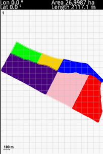
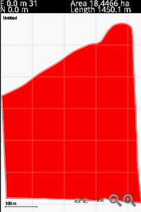
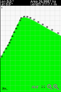
This program allows you to measure areas of any size, with a precision marked by your own GPS. The larger the area, the better the measure. The perfect tool for field and farm work. Combine this App with the free program “gpmReport” for send the measurements to printer in one single step.
The main features are:
– Coordinates Lat/Lon, UTM
– Precise Calculation of the area using projection UTM
– Precise reading of the position of the GPS using averages
– Units of measurement: Metric system or Imperial
– Export data in ESRI Shapefile
– Export data in DXF
– Export data Google Earth KML
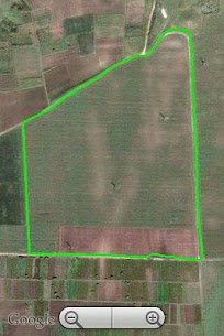
– Display measurements under Google Maps
– Scales and Zoom
– Computes distance between cursor coordinates of map.
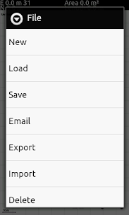
– Email directly the measurement file.
– Email directly the exported files.
– Import SHP files into map (polygons, arcs and points).
– Set the size of font in screen.
– Languages: English, Deutsch, French, Russian, Spanish, Portuguese, Polish, Czech , Hebrew and Turkish.
This program is compatible to file level with “GPSMeter PDA”, so that you can also use “gpmReport” to see and print your measures in your PC. See http://www.gpsmeter.com/index.php?page=gpmreport
You can also upload the *.gpm file directly to the GPS Visualizer online utility.
More info about http://www.gpsmeter.com/index.php?page=android
What's new
The new update include these changes, based on the request of users:
- Fixed bug that avoiding show the MENU under some devices (example, Google Galaxy Nexus)
- Function for Delete files from SD card
- Computes distance between cursor coordinates of map.
- Email the measurement file.
- Email the exported files.
- Import SHP files into map (polygons, arcs and points).
- Option for set the size of font in screen.
- Added Tuskish language.
Related apps


Most rated apps
Most viewed Apps
 KartRider Rush+ 1.24.8 Apk1.24.8 NEXON Company
- BooleanTT – Boolean Algebra (PREMIUM) 2.0.7.2022 Apk2.0.7.2022 Hashan Chamara Rajapaksha
- UpdatedContacts 4.28.25.618005846 Apk4.28.25.618005846 Google LLC
- Scan Hero: Document to PDF Scanner App (PREMIUM) 1.5 Apk1.5 Apalon Apps
- UpdatedInstagram 325.0.0.35.91 Apk325.0.0.35.91 Instagram
Latest Apps
- UpdatedMobileSheets (PRO) 3.8.40 Apk3.8.40 Zubersoft
- UpdatedInstaSize Photo Editor+Resizer (PRO) 4.3.2 Apk4.3.2 Instasize Inc.
- Updated
 MT Manager (VIP) 2.15.2 Apk2.15.2
 - UpdatedmySugr – Diabetes Tracker Log (PRO) 3.101.0 Apk3.101.0 mySugr GmbH
- UpdatedLearn English Sentence Master (PREMIUM) 1.11 Apk1.11 MasterKey Games